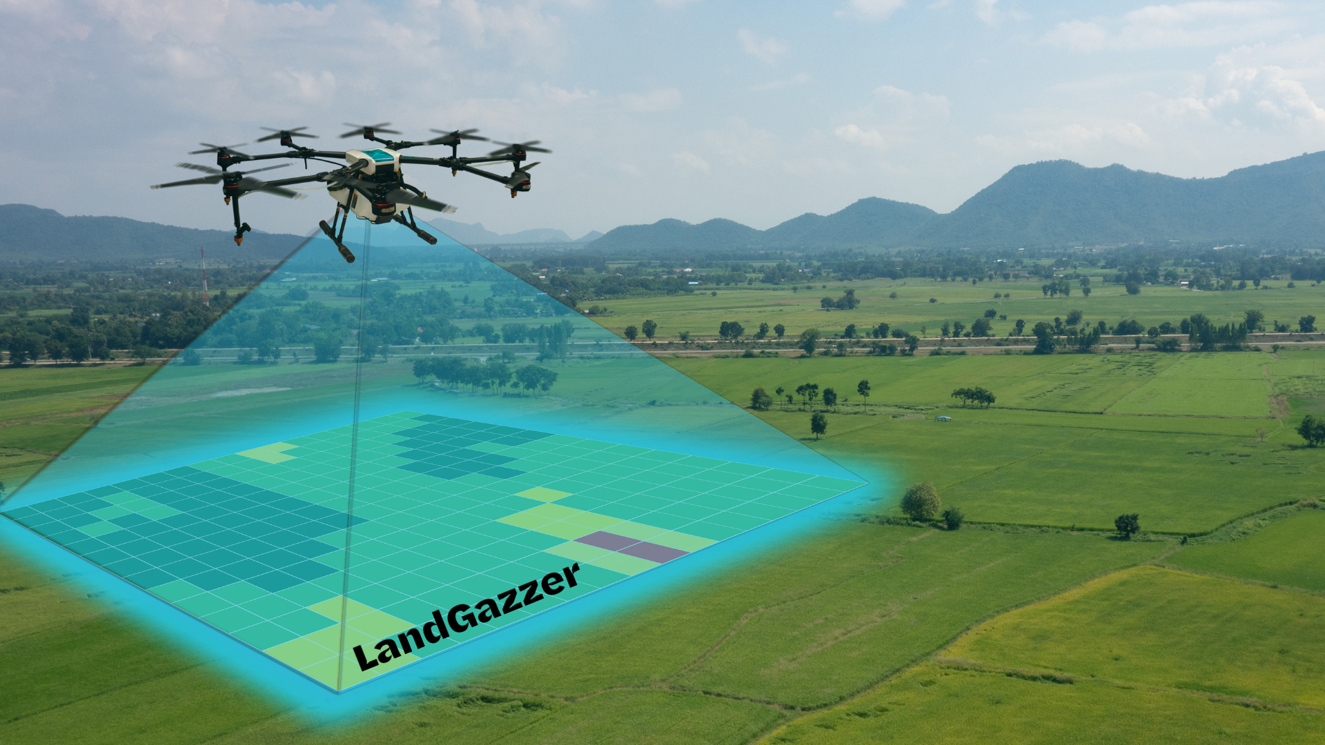
How LandGazzer Is Powering the Future of Construction with Drone Mapping & Creating Lifetime Commissions for U.S. Based Sales Agents
Ready to Sell Drone Mapping into a Booming Market?
If you're a U.S.- based B2B independent sales pro with relevant industry contacts, LandGazzer offers one of the most lucrative, forward-thinking sales programs available right now. Read below for full details.
You’ll be at the center of a $75 billion tech transformation and paid like a partner.
Learn more or apply today via CommissionCrowd.com
The Infrastructure Revolution Is in the Air
In the race to build America’s next generation of cities, highways, data centers, and energy infrastructure, one factor is separating the winners from the rest: access to precise, real-time site data.
LandGazzer, a U.S.-based drone mapping and geospatial intelligence company, is at the forefront of this transformation - offering high-accuracy, fast-turnaround drone surveying solutions that are changing how construction, engineering, and land development teams operate.
But the big news? They're inviting commission-based independent sales agents to ride the wave and earn lifetime residual sales commissions in one of the fastest-growing markets in the world!
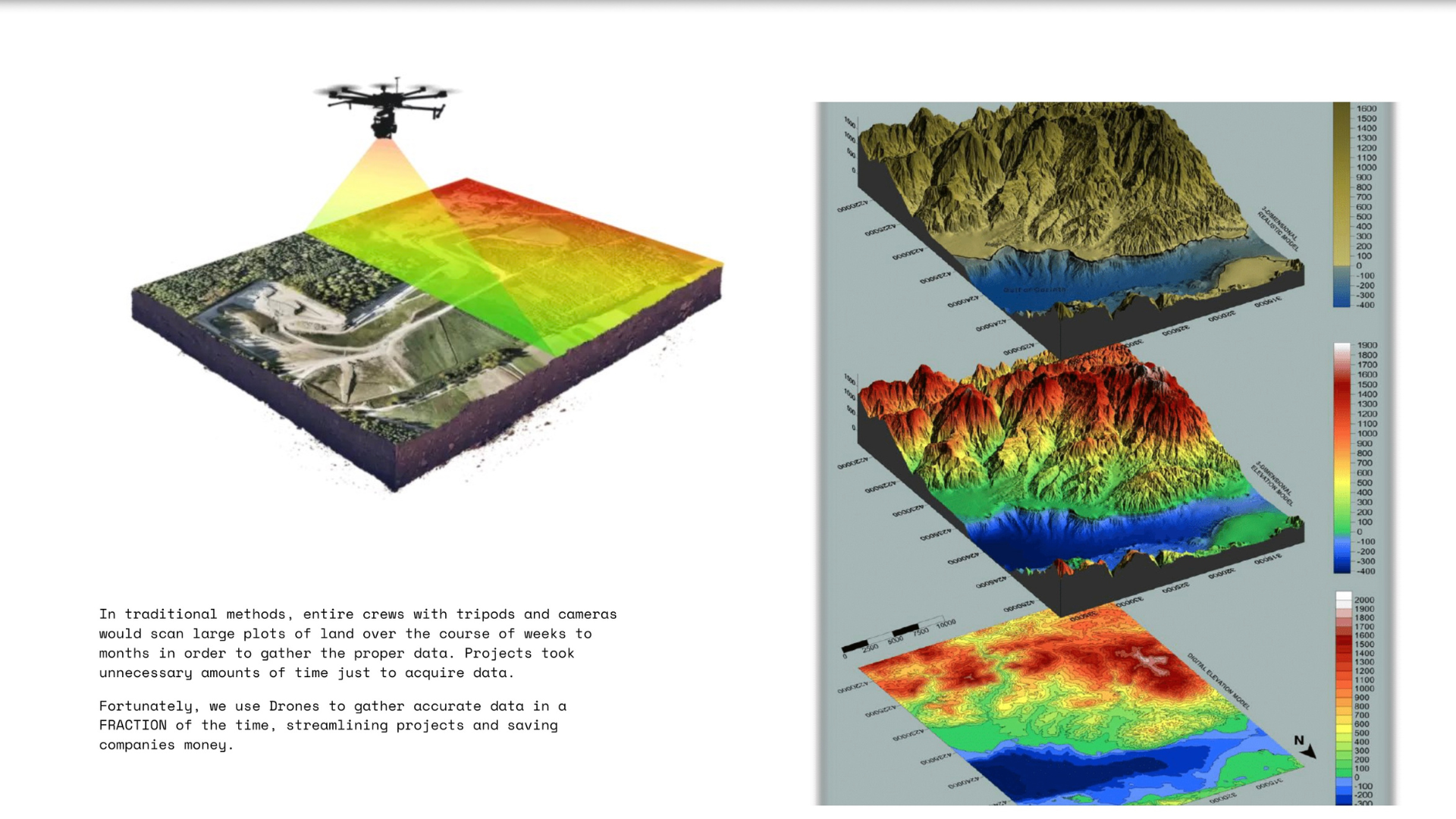
“The old model of sending a crew out to survey land with tripods and total stations just isn’t fast or scalable enough anymore” says Torey Thompson, founder of LandGazzer.
“With drone-powered mapping and cloud-based data delivery, we’re helping construction and civil engineering teams work safer, smarter, and faster, and that creates a huge sales opportunity.”
The Drone Surveying Market: $75 Billion in Growth by 2025
According to industry forecasts and market analysts - including data from the Department of Trajectory - the global market for drone surveying, LiDAR mapping, and remote construction data is expected to grow by $75 billion by 2025.
Why? Because drones unlock a new level of scalability and insight for industries that have long relied on outdated and manual methods.
- Construction companies can run biweekly flyovers for active job sites
- Civil engineers can access BIM-ready models without delays
- Land surveyors and urban planners can cover massive tracts of land in hours, not days
- Environmental agencies and agriculture consultants can monitor terrain shifts, soil health, or irrigation patterns with precision
This level of data visibility creates recurring need—and recurring revenue—for those selling it.
What Makes LandGazzer Different?
LandGazzer is not just a drone operator. It’s a full-service data intelligence platform that offers:
- Up to 2 cm precision across every flight
- Nationwide network of vetted U.S. drone pilots
- Global team of GIS specialists for cloud processing
- Fast turnaround—most jobs are delivered in under a week
- Outputs designed for CAD, BIM, and permitting workflows
“Our edge is speed, scalability, and fit-for-purpose data” Thompson explains.\
“We’ve made it simple for construction managers to get exactly what they need - without holding up permits, scheduling delays, or paying for unnecessary field teams.”
A Lifetime Recurring Commission Sales Opportunity for B2B Independent Sales Reps
For U.S.-based independent sales professionals, LandGazzer’s sales program is structured for long-term, passive income. Here's how it works:
- You sell once to a construction or engineering firm
- We deliver the drone service and data
- You keep earning commissions on every future project that client books - biweekly site flights, follow-ups, expansion sites, and more
Sales Commission Structure:
- 20–25% commission on every project
- LIFETIME residuals on recurring clients
- Typical project values: $2,000–$5,000 (with six-figure potential)
- Fast payout: 7 days after client payment
Ideal Sales Profiles & Target Networks
If you’ve sold to land developers, general contractors, infrastructure planners, or civil engineers, this is a perfect fit for your sales portfolio!
This opportunity is ideal for:
- Independent Sales reps in construction SaaS
- Surveying and GIS equipment resellers
- BIM/CAD tool consultants
- Real estate engineering reps
- Environmental services sales
- Utility, agriculture, and telecom sales agents
You'll thrive if you have connections in:
- Land surveying firms
- General contracting and site planning
- State infrastructure agencies
- Agribusiness or commercial real estate development
- Smart city or renewable energy site planning
Landgazzer Drone Services Overview
We provide advanced geospatial and digital modeling solutions across engineering, construction, land surveying, agriculture, and real estate sectors, leveraging cutting-edge technologies such as 3D laser scanning, drone photogrammetry, and LiDAR.
- Engineering & BIM We offer Scan-to-BIM services using 3D laser scanning to convert as-built environments into precise Building Information Models (BIM) for design, renovation, and construction projects. This enhances accuracy, reduces errors, and streamlines inspections and measurements.
- Land Surveying & Agriculture Using Photogrammetry and LiDAR scanning, we create detailed Topographical Maps and Digital Elevation Models (DEMs) for applications such as urban planning, flood risk assessment, environmental monitoring, and infrastructure development. Our data captures terrain features and elevation changes with high precision.
- Construction Our drone-based photogrammetry and LiDAR solutions support site analysis, project management, visual inspections, and construction monitoring. These tools ensure design accuracy, optimize planning, and reduce project costs by delivering actionable data throughout the build process.
- Real Estate We accelerate real estate project timelines by up to 90% through Drone LiDAR scanning, enabling detailed property analysis, virtual tours, space planning, and marketing. Our services enhance decision-making, reduce development risks, and improve client engagement with immersive, data-driven visuals.
Tools, Training & Support
Even if you’ve never sold drone mapping services before, LandGazzer trains you up fast:
- Industry-specific demo assets (construction, engineering, architecture)
- Pricing calculator to quote with confidence
- Sample deliverables and case studies
- Founder-led onboarding + Q&A support
“You don’t need to know how to fly a drone” says Thompson. “You just need to understand what a construction manager or surveyor cares about: speed, accuracy, and insight. If you can translate that into value, you’ll win.”
Why This Market Needs You Now
Here’s the reality:
- Every month, new federal and state funding is being released for infrastructure projects
- Construction timelines are shrinking, while data demands are rising
- Traditional survey teams are understaffed and overbooked
- Precision data is becoming a strategic advantage, not just a compliance step
That’s where you come in: LandGazzer needs relationship-driven, B2B-savvy independent sales professionals who can speak the language of field teams, permit departments, and procurement.
Why Independent Sales Reps Are Joining LandGazzer
- Lifetime commissions - your deals keep paying long after you close
- Cold leads provided - so you can focus on consultative selling Recurring project cycles - construction needs ongoing site scans
- Tech that sells itself - demo assets close deals visually
- Direct access to the founder - no red tape, just support
“When our independent sales rep partners win, we all win” says Thompson. “We're building something lasting. And we want the best people beside us - not just selling, but shaping what this industry becomes.”
Ready to Sell Drone Mapping into a Booming Market?
If you're a U.S.-based B2B sales pro with relevant industry contacts, LandGazzer offers one of the most lucrative, forward-thinking sales programs available right now.
You’ll be at the center of a $75 billion tech transformation and paid like a partner.
Learn more or apply today via CommissionCrowd.com
